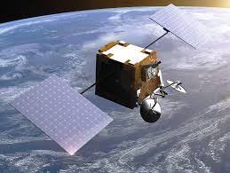
The projects will trial systems that use satellite data and services to support transport, logistics and financial services. The largest award for a single project is £400,000.
According to the agency, the trials will combine terrestrial data and technology – such as AI, quantum and geospatial data – with satellite data and services. The aim is to provide “deeper analysis to develop insights and present new solutions to UK customers”.
“This government is embracing the power of technology to improve lives and support businesses to thrive,” said Department for Science, Innovation and Technology Minister Chris Byrant.
“We have a fast-growing space sector in the UK but for too long we have struggled to tap the huge potential of satellite data to drive positive change in the real world. These new projects seek to unlock this potential by combining data from space with cutting-edge technologies here on Earth.”
For example, in one of the projects, Octopus Investments has partnered with Treeconomy, a company that uses AI and remote sensing to measure the impact of nature restoration projects.
It will use a variety of satellite-based Earth observation data sources including Landsat and Sentinel-2, as well as localised drone-based data. This will be to better support the evaluation of nature projects and a suite of environmental metrics that would inform investment decisions.
“Unlocking Space for Business is set up to identify and help tackle barriers facing organisations that have not traditionally used satellite data or services, or considered how space can benefit their bottom line,” added Byrant.
Projects
The following businesses and their projects – described in the Space Agency’s won words – have been awarded grants under the Unlocking Space for Business grant.
Admiral Group Plc – Assessing subsidence-related insurance claims risk using satellite radar.
Use SAR satellite data to form an assessment of subsidence claims risk, to better understand the subsidence risk of given areas of the country and offer more competitive pricing to customers.
Citigroup – Measuring Nature-Related Footprint: Corporate Impacts and Risks Quantified
In partnership with Earth Blox, develop a market-leading geospatial and satellite data tool that enables a systematic and facility level screening of corporate nature-related impact and dependency across multiple sectors and geographies.
Equitix Limited – Renewable energy resilience powered by satellite-derived climate models
In partnership with climate modelling experts Sust Global, research and develop AI powered, satellite-derived forward-looking climate models to understand how changing wind resources may impact wind asset operational and financial performance.
Foresight Group – Advancing Satellite-derived Insights for Nature and Climate Management and Disclosure
Development of Frontierra’s nature and climate reporting platform, assessing 600 assets to enhance their nature and climate related risk management and associated reporting to bolster decision making capabilities and improve ESG outcomes.
Level E Research Limited – AI Risk Index (AIRi)
Develop an AI Risk Index to assess the impact of potential environmental events on an investment, to enhance decision processes and increase overall operational efficiency.
Octopus Investments Ltd & Treeconomy Ltd – Earth Observation for Natural Capital Investments
Developing satellite-based tools to support data-driven investment decisions related to nature-based carbon projects, including afforestation. This aims to support more streamlined, confident and impactful allocation of private finance towards high-quality nature restoration efforts across carbon and natural capital markets.
Safe Earth Solutions Ltd – Accelerating adoption of nature-related financial derivatives using Earth Observation data
Financial services product development underpinned by their AI-powered Nature Valuation and Monitoring Platform to unlock new derivatives and investment into nature credits in pursuit of net zero and ESG goals.
Shipping Strategy Ltd – Risk Scoring for Maritime Hull and Machinery Insurance
Utilise Morphing’s AI’s software to identify short-term risk factors of maritime incidents, by combining satellite data from AAC Clyde Space with contextual commercial and ship technical data, and historical marine casualty data.
Sports City Management Company – EventGo 5.0: AI-enabled Earth Observation for Travel Demand Management
Use machine learning to analyse earth observation data and fan travel data, to enable Etihad Campus in Manchester to enhance visitor travel to reduce congestion and carbon emissions.
WieldMore Investment Management Limited – CERES – Comprehensive Environmental Risk Evaluation System
Integrate satellite data with financial models to assess the impact of climate and nature risks on manufacturing, energy and agriculture sectors.
See also: UK Space Agency sizes the UK Space Industry


