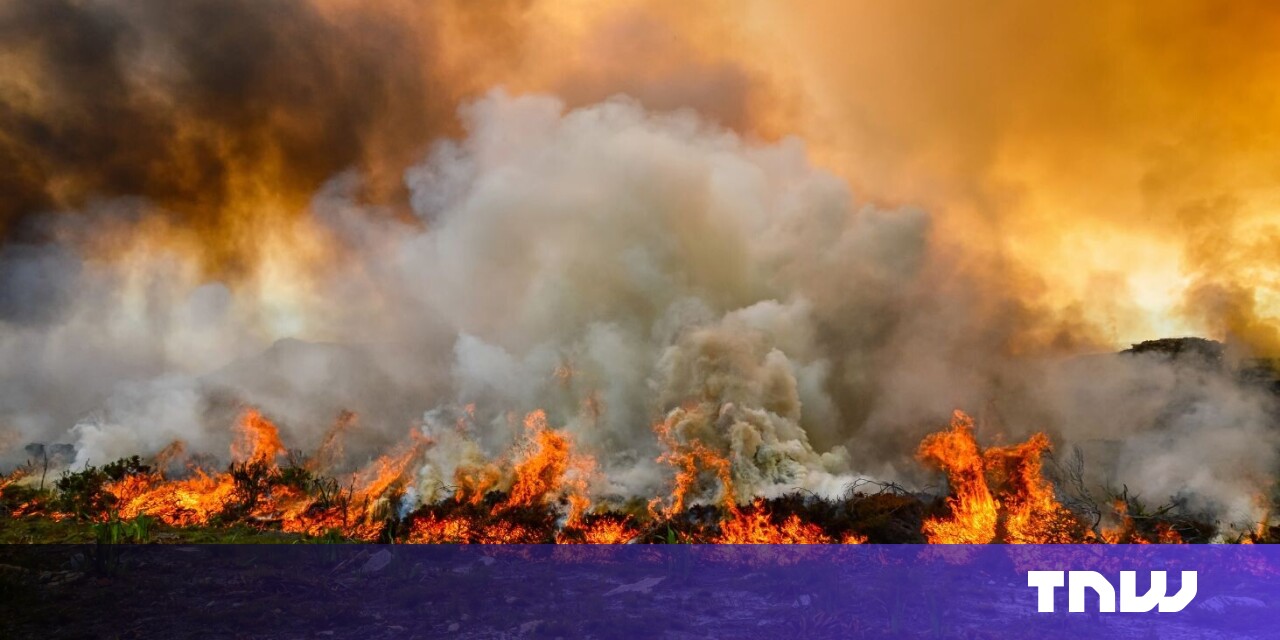
In recent weeks devastating wildfires have swept across Greece, Italy, Spain, and Portugal, causing several fatalities, the displacement of thousands of people, and widespread damage to infrastructure.
More than 260,000 hectares of land across the EU has already burnt since January — an area the size of Luxembourg. Many fires are still raging across swathes of southern Europe and beyond.
In response to the increasing threat of wildfires, the European Space Agency has released an upgraded version of its World Fire Atlas which harvests satellite data to track the blazes.
Through the dashboard, users can compare the frequency of fires between countries as well as analyse the evolution of fires taking place over time. The atlas was originally launched in 2019, where it supported both European civil protection agencies and firefighters.

The tool uses night-time data from the Sea and Land Surface Temperature Radiometer on board Copernicus Sentinel-3A, Europe’s primary earth observation satellite.
Working like a thermometer in the sky, the sensor measures thermal infrared radiation to take the temperature of Earth’s land surfaces which is used to detect fires.
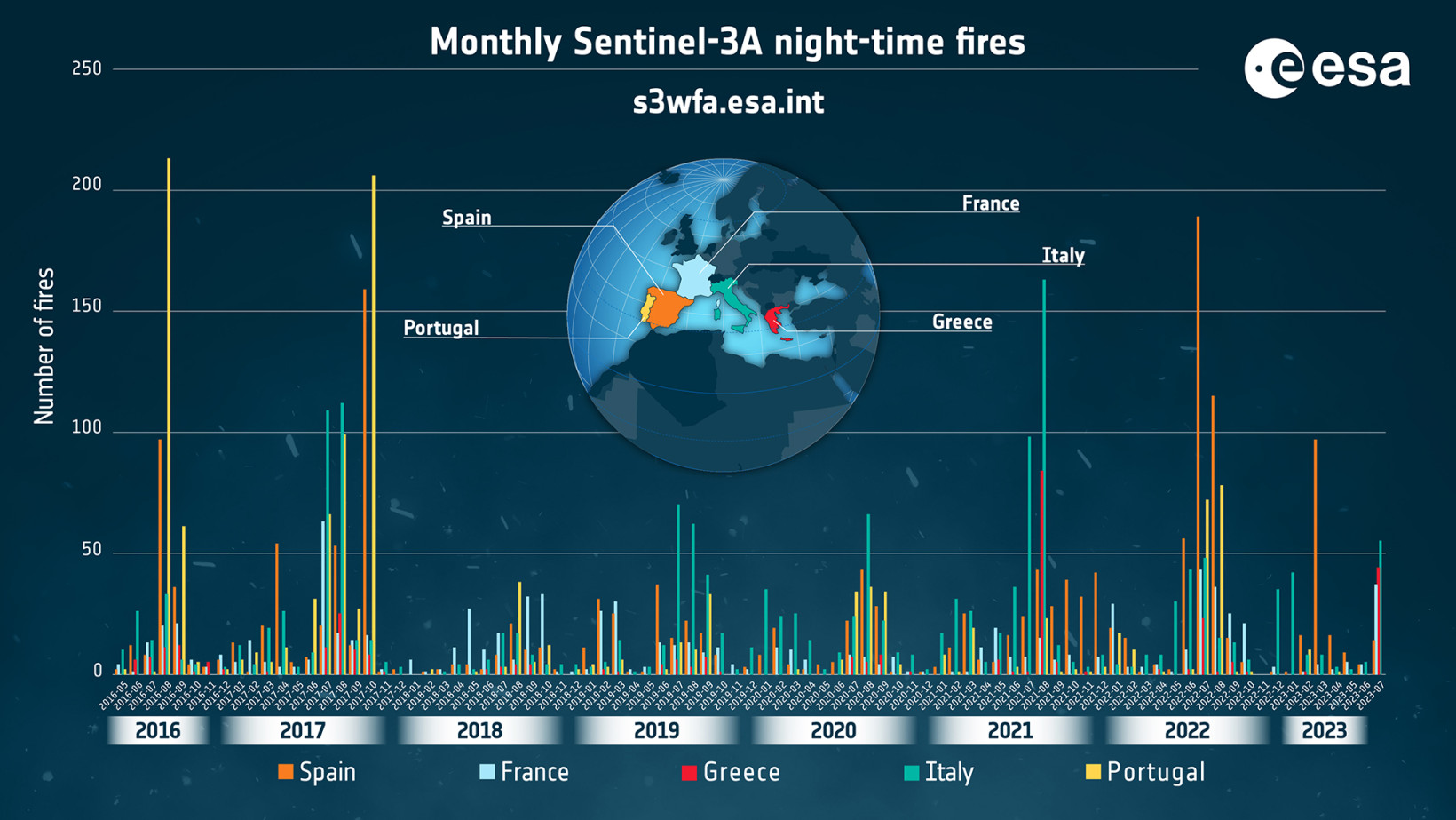
Over the previous seven years, data from the World Fire Atlas shows a significant number of fires detected in Portugal, Italy, Greece, France, and Spain. The highest number of fires reached in that timeframe was in Portugal in August 2016 and October 2017.
While wildfires are a natural part of many ecosystems, scientists have warned that they are becoming more frequent and more widespread as climate change brings hotter, drier conditions in many parts of Europe.

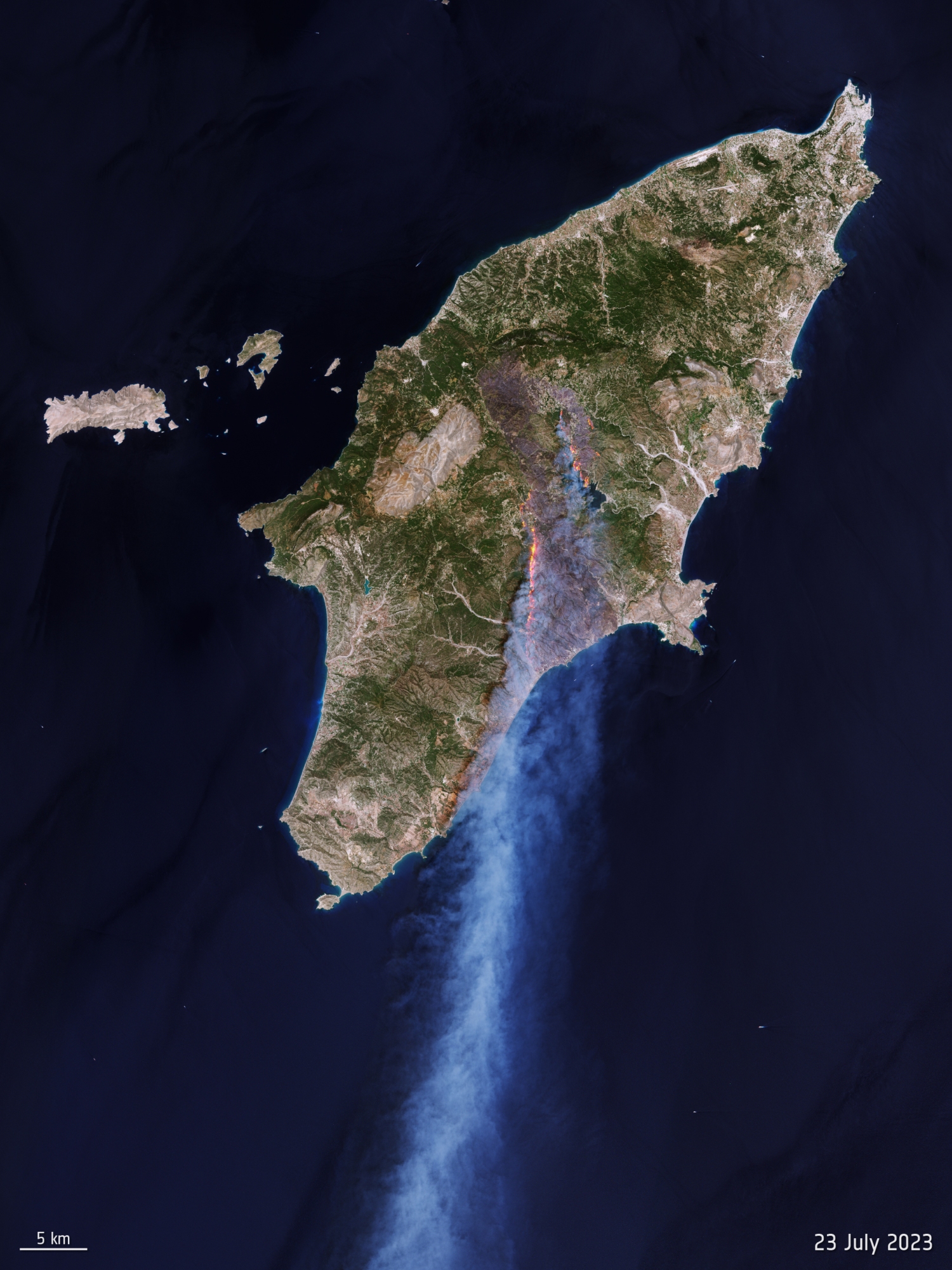
On Rhodes in July, some 50,000 hectares burnt in just a week, forcing almost 20,000 people to flee the Greek island. The Copernicus rapid mapping service, which supports authorities with geospatial information during emergencies, was activated for this event and helped firefighters battle the blaze.
By utilising satellite data, the ESA believes authorities, researchers, and organisations can devise more effective strategies for fire prevention and management.
“The ongoing commitment of ESA, Copernicus, and the EU to continuously provide this valuable resource reinforces the importance of leveraging space technology to address critical environmental challenges,” said Olivier Arino, head of the ESA’s Earth Observation Projects Section.


![Speed up Haptic Touch with this hidden iPhone setting [Pro Tip] Speed up Haptic Touch with this hidden iPhone setting [Pro Tip]](https://www.cultofmac.com/wp-content/uploads/2023/08/Make-Your-Phone-Snappier.jpg)


