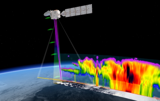
It’s a flagship mission for ESA and EarthCARE stands for Earth Cloud Aerosol and Radiation Explorer. It has been described as ESA’s largest and most complex Earth Explorer spacecraft.
EarthCARE
The data should help improve the accuracy of climate and numerical weather prediction models. Specifically, how do clouds and aerosols affect the heating and cooling of our atmosphere? his involves trapped infrared radiation emitted from Earth’s surface.
Eventually, data from all four of its instruments will combine to provide a full analysis.
The four instruments are: an atmospheric lidar (to measure the vertical profile of aerosols and clouds in Earth’s atmosphere along the EarthCARE track), a cloud profiling radar (operating in the millimetre-wavelength range to study the formation and dissipation of clouds for climate models), a multispectral imager (providing a wider field of view to give context to the profile measurements) and the Broadband radiometer (viewing the atmosphere from three directions to quantify the amount of reflected solar radiation and the outgoing thermal radiation emitted by Earth).
Data from EarthCARE has so far only been available to the ESA project teams, but now this initial ‘first level’ data stream will be publicly available.
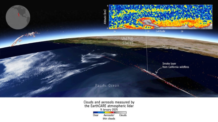
Pictured below is an EarthCARE images sampling smoke from the Los Angeles wildfires. (Smoke is one type of aerosol.)
“It is not only the largest Earth Explorer mission we’ve ever developed, but it’s also the most complex,” said ESA’s Director of Earth Observation Programmes, Simonetta Cheli. “Anybody who wishes, can now start reaping the benefits of the years of work [on] this extraordinary satellite as the data is freely available with open access to all.”
“We now look forward to seeing how using the data will result in new scientific findings about the changing atmosphere, particularly against the backdrop of the climate crisis.”
Second level
Public release of a second level of processed data – Level-2 – will follow, says ESA.
It says the release of multiple instrument Level-2 products will gradually begin “over the following months”.
“ESA is responsible for these Level-1 from the atmospheric lidar, multispectral imager and the broadband radiometer,” said ESA’s EarthCARE Mission Manager, Bjoern Frommknecht. “Our thanks go to JAXA for the Level-1 data from the cloud profiling radar.”
“Public release of the second level processed data, Level-2, will follow, with release of the single instrument data anticipated in March and release of multiple instrument Level-2 products phased over the following months.”
International
More than 200 research institutes and 45 companies across Europe were involved in developing EarthCARE.
You can watch a stream of the launch from the Vandenberg Space Force Base in California last May:
Images: ESA
See also: Picture of the Day: ESA satellite encapsulated in rocket fairing


